Search News
Industry Portal
Popular Tags
Remote Sensing Drones Cost: What Drives Total Spend?
Author
Time
Click Count
Why does remote sensing drones cost vary so much between projects?
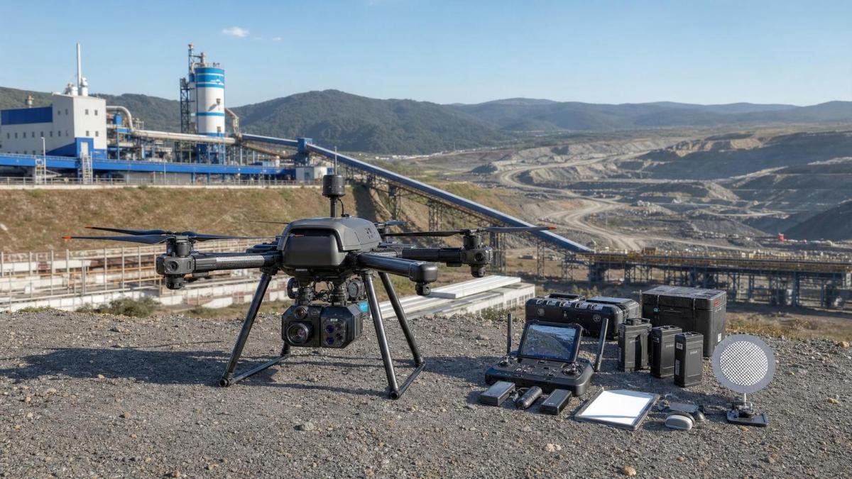
Remote sensing drones cost is rarely defined by the aircraft alone. In most industrial programs, the airframe is only one line in a much wider budget.
A lower-priced drone can become expensive once payloads, processing software, operator training, and compliance work are added. A premium platform may look costly upfront, yet reduce repeat flights and downtime.
That is why total spend matters more than sticker price. The useful question is not, “What does the drone cost?” but, “What does dependable data collection cost over time?”
In practice, remote sensing drones cost depends on mission accuracy, operating conditions, data volume, and how deeply the output connects with enterprise systems.
For industrial ecosystems shaped by automation and material efficiency, this cost logic becomes even more important. G-AIE benchmarking work often shows that data quality failures create larger losses than moderate hardware premiums.
What are you really paying for beyond the drone itself?
This is where many budgets drift. Remote sensing drones cost usually expands across five spending layers, and each one can affect approval risk.
- Airframe and flight control system, including batteries, chargers, and ground station hardware.
- Sensors, such as RGB, multispectral, LiDAR, thermal, or hyperspectral payloads.
- Software for mission planning, photogrammetry, analytics, storage, and integrations.
- Operational readiness, including certification, training, insurance, and standard procedures.
- Lifecycle support, covering repairs, calibration, firmware support, replacement parts, and service agreements.
The most common budgeting error is to treat sensors and software as optional add-ons. For remote sensing work, they are central to business value.
A drone collecting surface images for simple site inspection has one cost profile. A platform generating georeferenced models for mining, utilities, or industrial construction has another.
The table below helps frame where remote sensing drones cost typically rises fastest.
Does sensor choice change remote sensing drones cost more than expected?
Very often, yes. Sensor selection is usually the fastest way for remote sensing drones cost to move from manageable to strategic.
RGB cameras are generally the entry point. They support mapping, visual inspection, and progress monitoring with moderate processing needs.
Thermal sensors add diagnostic value for energy, utilities, and facility monitoring, but they also require interpretation discipline and calibration care.
Multispectral payloads become relevant when surface condition, vegetation response, or material variation needs to be quantified rather than viewed.
LiDAR changes the budget most sharply. It supports dense terrain modeling and penetration through light vegetation, yet hardware, software, and post-processing costs are much higher.
The key is matching sensor capability to decision value. Paying for precision that no downstream workflow uses is waste. Underbuying creates repeat capture, disputed measurements, and slower approvals.
A practical review question is simple: what exact operational decision will this sensor improve, and what is the cost of being wrong without it?
When does the cheaper option become the more expensive one?
This happens when a low initial quote hides high execution friction. Remote sensing drones cost should be tested against reliability, workflow fit, and lifecycle demands.
A lower-cost unit may have shorter flight time, weaker wind tolerance, limited payload compatibility, or slower processing support. Those limits add labor and delay.
For industrial sites, environmental stress matters. Dust, heat, electromagnetic interference, and remote operating conditions can expose the true cost difference very quickly.
Another issue is data interoperability. If outputs do not connect cleanly with CAD, GIS, ERP, or digital twin systems, teams spend extra time converting files and checking errors.
More often than not, the more expensive mistake is a system that cannot scale from pilot project to enterprise program.
- Check whether the platform supports future payload upgrades.
- Review replacement part lead times and regional service coverage.
- Confirm data export standards before approval.
- Model downtime costs, not just purchase costs.
That broader view is consistent with how technical benchmarking platforms such as G-AIE assess physical assets: performance has to be measured with digital usability, not in isolation.
How should remote sensing drones cost be evaluated over a three-year cycle?
A three-year view is usually more useful than a one-time capital comparison. It reveals whether the program is genuinely efficient or simply cheap at entry.
Start by separating fixed costs from variable costs. Then test how usage volume changes the unit economics of each flight mission or inspected asset.
Typical fixed costs include platform purchase, setup, training, and initial software licenses. Variable costs include maintenance, insurance renewals, battery replacement, and processing volume.
The hidden category is event-driven cost. Crash recovery, emergency part replacement, recalibration, and delayed field windows can distort annual spending.
A useful evaluation checklist looks like this:
- Projected annual flight hours and mission frequency.
- Expected sensor utilization by application.
- Data processing volume per month.
- Internal labor needed for flight, analysis, and reporting.
- Estimated cost of mission rework or failed capture.
- Residual value or replacement timing after year three.
When remote sensing drones cost is reviewed this way, the strongest proposals are usually the ones with predictable serviceability and stable data pipelines.
What cost risks are most often missed during approval?
Several cost risks appear late because they sit outside the initial quote. They are rarely dramatic on paper, but together they reshape total ownership cost.
One is training drift. Teams may be certified initially, yet turnover or infrequent use erodes operational consistency. Refresher training then becomes necessary.
Another is software dependency. Some vendors price hardware competitively, then recover margin through recurring cloud processing and storage fees.
Battery economics are also underestimated. Intensive missions, temperature extremes, and fast charging habits can shorten battery life well before forecast.
There is also a governance issue. If data retention, cybersecurity, or geographic hosting rules are unclear, remediation costs can appear after deployment.
For that reason, remote sensing drones cost should be reviewed with operational, digital, and compliance assumptions on the same page, not in separate approvals.
A quick decision table for screening proposals
So what is the smart next step when comparing remote sensing drones cost?
Start with the output required, not the aircraft catalog. The right cost benchmark depends on whether the goal is inspection evidence, 3D measurement, thermal diagnostics, or multi-layer geospatial analysis.
Then build a short comparison model with three lenses: acquisition cost, operating cost, and cost of unusable or delayed data.
That framework usually produces cleaner decisions than broad price shopping. It also helps separate premium capability from unnecessary specification.
Remote sensing drones cost becomes easier to justify when every major expense is linked to a measurable workflow outcome, service condition, or avoided risk.
A disciplined review should map sensors, software, compliance, and support into one lifecycle view. From there, compare proposals against actual site conditions and data requirements, then validate assumptions with benchmark evidence before final approval.
Recommended News
 Sep 19, 2026When can a supply chain LLM reduce time spent finding shipment updates?Supply chain LLMs can cut shipment-update search time by connecting carrier events, ERP data, and documents—giving teams traceable answers and faster exception response.
 Sep 18, 2026How industrial monitoring equipment helps prevent unplanned downtimeIndustrial monitoring equipment helps teams detect early asset issues, prioritize maintenance, and prevent costly unplanned downtime. Explore practical strategies for reliable operations.
 Sep 17, 2026What next-gen harmonic drive research means for robot joint accuracyNext-gen harmonic drive research reveals how backlash, stiffness, thermal drift, and sensing shape robot joint accuracy. Explore smarter validation strategies.
 Sep 16, 2026How Southeast Asian climates affect cylinder seal frictionCylinder seal friction Southeast Asia: learn how humidity, heat, monsoons, and contamination affect motion stability, wear, and seal selection.
 Sep 15, 2026How to size DC gear motors for the required starting torqueGear motors DC sizing made practical: calculate starting torque, account for friction, gravity, inertia and voltage drop, then select a reliable motor with confidence.
 Sep 14, 2026How to verify high purity chemicals compliance before supplier approvalHigh purity chemicals compliance: learn how to verify supplier quality systems, CoAs, traceability, testing, and change control before approval.
 Sep 13, 2026What permits are needed to operate mapping drones in Europe?Mapping drones Europe: discover the permits, EASA categories, airspace approvals, site access, and GDPR checks needed for compliant aerial surveys.
 Sep 12, 2026What lead time should I expect for automatic transmission components? Planetary Gearboxes delivery forecasting for OEM planningWhat lead time should I expect for automatic transmission components? Get dynamic, AI-powered planetary gearbox delivery forecasting—designed for OEMs building next-gen hybrid & commercial powertrains.
 Sep 12, 2026Can polyamide replace metal in load-bearing components? Polymer Pulse structural performance data for 2026 applicationsCan polyamide replace metal in load-bearing components? Discover Polymer Pulse’s 2026 structural data—real-world performance, weight savings, and reliability breakthroughs.
 Sep 12, 2026How to handle a power electronics warranty claim: Harmonic Reducers documentation and escalation pathHow do I handle a power electronics warranty claim? Get a fast, intelligent, evidence-driven resolution for harmonic reducers—no bureaucracy, just precision diagnostics and real-time escalation.
 Sep 12, 2026Which motion control specifications matter most before purchase? Torque Logic selection criteria for automation engineersWhich motion control specifications are most important before purchase? Discover Torque Logic—the 4 non-negotiable, AI-aligned criteria that cut TCO by 27–41% and boost motion system availability to 99.992%.
 Sep 13, 2026Is agentic AI reliable enough for supplier screening? Supply Chain LLM validation framework for procurement teamsIs agentic AI reliable enough for supplier screening? Discover a rigorous LLM validation framework built for procurement teams—grounded in material traceability, regulatory compliance, and real-world operational constraints.
 Sep 14, 2026How to maintain edge AI systems after deployment: Predictive Maint AI operational protocols for field techniciansHow do I maintain edge AI systems after deployment? Discover predictive, physics-aware operational protocols designed for real-world field technicians—sustaining intelligence where silicon meets steel.
 Sep 15, 2026What compliance documents must a bioplastics supplier provide? Bio-Plastics regulatory checklist for procurementWhat compliance documents should a bioplastics supplier provide? Get our actionable regulatory checklist for food, medical & EU-bound applications.
 Sep 16, 2026How to prevent PET film defects during production: Barrier Films process control best practicesHow can I prevent PET film defects during production? Discover physics-driven barrier film process control—thermal precision, dynamic tension management & surface energy optimization.
 Sep 17, 2026Are thermoplastics suitable for long-term outdoor use? Engineering Resins durability assessment in 2026 UV/weather exposureAre thermoplastics suitable for long-term outdoor use? Discover 2026’s engineering resin durability insights — UV/weather resistance ranked, tested & actionable.
 Sep 18, 2026What to do when a servo motor fails during production: A Servo Actuators troubleshooting guide for maintenance teamsWhat should I do if a servo motor fails during production? Get a field-tested, AI-aware troubleshooting guide for maintenance teams—minimize downtime, maximize OEE.
 Sep 12, 2026How to compare wholesale party supplies by minimum order valueCompare wholesale party supplies by minimum order value, freight, SKU flexibility, and stock risk to choose suppliers that protect margins and simplify replenishment.
 Sep 11, 2026How proportional solenoid linearity affects precision motion controlProportional solenoid linearity directly affects precision motion control, valve metering, stability, and calibration. Learn how to evaluate performance for reliable automation.
 Sep 10, 2026When does supplier information platform automation reduce onboarding delays?Supplier information platform automation reduces onboarding delays by streamlining data collection, routing, renewals, and compliance checks—without replacing expert technical review.
 Sep 09, 2026How to size robotic motion systems for AMR payload changesRobotic motion systems for AMR payload changes: learn how to size motors, wheels, gearing, traction, and controls for safer, reliable performance.
 Sep 08, 2026How to perform a cylinder rod buckling calculation for long strokesCylinder rod buckling calculation made practical: learn how to assess effective length, end conditions, rod stiffness, load forces, and safety margins for reliable long-stroke cylinder design.
 Sep 07, 2026How to estimate the cost of industrial mechanical components before orderingIndustrial mechanical components cost: learn how to estimate material, machining, tooling, inspection, logistics, and hidden expenses before ordering. Compare quotes confidently and reduce sourcing risk.
 Sep 07, 2026What Is a Product Standards Database Used For?Product standards database guide: learn how to compare requirements, verify revisions, control specifications, and reduce compliance risks across design, sourcing, and production.